
Irene ha creato una guida
Visite turistiche
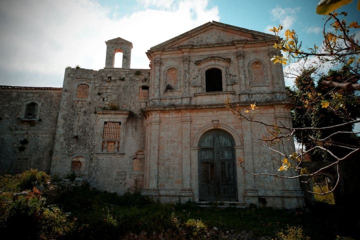
Noto antica ovvero Netum, è l'antico abitato di Noto distrutto a seguito del terremoto dell'11 gennaio 1693. Municipium sotto il dominio dei Romani, capovalle dalla dominazione araba in poi e fregiata del titolo di Civitas ingegnosa da Ferdinando il Cattolico, fu patria di molti elementi di spicco fra il XIV e il XVI secolo, nonché uno dei principali centri culturali, militari ed economici della Sicilia sud-orientale. Circondata da imponenti mura (molte delle quali ancora in piedi) e da profonde vallate del monte Alveria, non fu mai presa con la forza. Solo il violento terremoto del 1693 riuscì a distruggerla, causando nel Val di Noto oltre 60 mila vittime.
Known ancient or Netum, it is the ancient town of Noto destroyed following the earthquake of 11 January 1693. Municipium under the dominion of the Romans, capovalle from the Arab domination onwards and decorated with the title of Civitas ingenious by Ferdinando the Catholic, was homeland of many prominent elements between the fourteenth and sixteenth centuries, and one of the main cultural, military and economic centers of south-eastern Sicily. Surrounded by imposing walls (many of which still stand) and deep valleys of Mount Alveria, it was never taken by force. Only the violent earthquake of 1693 succeeded in destroying it, causing over 60 thousand victims in the Val di Noto.
Noto Antica "La Collina della Memoria"
SP64Noto antica ovvero Netum, è l'antico abitato di Noto distrutto a seguito del terremoto dell'11 gennaio 1693. Municipium sotto il dominio dei Romani, capovalle dalla dominazione araba in poi e fregiata del titolo di Civitas ingegnosa da Ferdinando il Cattolico, fu patria di molti elementi di spicco fra il XIV e il XVI secolo, nonché uno dei principali centri culturali, militari ed economici della Sicilia sud-orientale. Circondata da imponenti mura (molte delle quali ancora in piedi) e da profonde vallate del monte Alveria, non fu mai presa con la forza. Solo il violento terremoto del 1693 riuscì a distruggerla, causando nel Val di Noto oltre 60 mila vittime.
Known ancient or Netum, it is the ancient town of Noto destroyed following the earthquake of 11 January 1693. Municipium under the dominion of the Romans, capovalle from the Arab domination onwards and decorated with the title of Civitas ingenious by Ferdinando the Catholic, was homeland of many prominent elements between the fourteenth and sixteenth centuries, and one of the main cultural, military and economic centers of south-eastern Sicily. Surrounded by imposing walls (many of which still stand) and deep valleys of Mount Alveria, it was never taken by force. Only the violent earthquake of 1693 succeeded in destroying it, causing over 60 thousand victims in the Val di Noto.
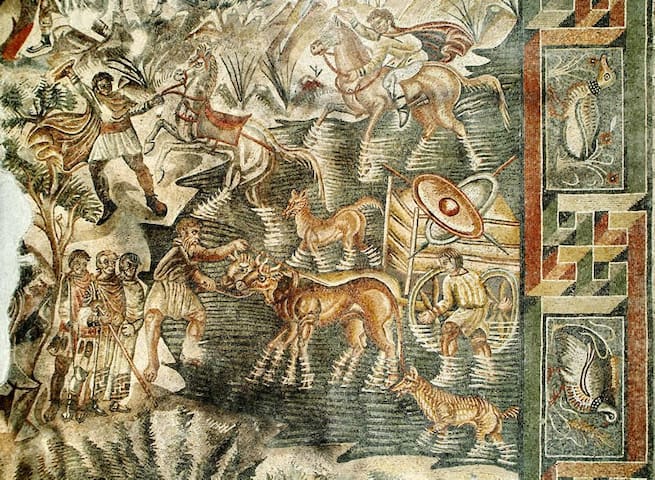
Nel 1971, nel corso di scavi illegali, fu scoperta una villa romana, di conseguenza si scavava nel territorio di Noto, nella provincia di Siracusa. Il complesso è situato a destra del fiume di Tellaro. La struttura si localizza leggermente in superficie, ma sotto una fattoria (masseria) del Diciottesimo secolo, dove si trovano le decorazioni musive.
Il lungo e difficile lavoro d'esplorazione, durato 20 anni, permise di portare alla luce la parte centrale del complesso antico.
Si tratta di un gran peristilio di circa 20 metri di lato circondato da un portico largo m.3,70, su cui danno diversi ambienti individuati sui lati nord e sud.
Il pavimento è formato da mosaici policromi con motivi geometrici. Nel nord si trovano tre aree che presentano pavimenti a mosaico.
In 1971, during illegal excavations, a Roman villa was discovered, consequently it was excavated in the territory of Noto, in the province of Syracuse. The complex is located to the right of the Tellaro river. The structure is located slightly above the surface, but under a farm (farm) of the eighteenth century, where the mosaic decorations are found.
The long and difficult exploration work, which lasted 20 years, allowed to bring to light the central part of the ancient complex.
It is a large peristyle of about 20 meters on each side surrounded by a porch of 3.70 meters wide, on which give different environments identified on the north and south sides.
The floor is formed by polychrome mosaics with geometric motifs. In the north there are three areas with mosaic floors.
29 คนท้องถิ่นแนะนำ
Villa Romana del Tellaro
Nel 1971, nel corso di scavi illegali, fu scoperta una villa romana, di conseguenza si scavava nel territorio di Noto, nella provincia di Siracusa. Il complesso è situato a destra del fiume di Tellaro. La struttura si localizza leggermente in superficie, ma sotto una fattoria (masseria) del Diciottesimo secolo, dove si trovano le decorazioni musive.
Il lungo e difficile lavoro d'esplorazione, durato 20 anni, permise di portare alla luce la parte centrale del complesso antico.
Si tratta di un gran peristilio di circa 20 metri di lato circondato da un portico largo m.3,70, su cui danno diversi ambienti individuati sui lati nord e sud.
Il pavimento è formato da mosaici policromi con motivi geometrici. Nel nord si trovano tre aree che presentano pavimenti a mosaico.
In 1971, during illegal excavations, a Roman villa was discovered, consequently it was excavated in the territory of Noto, in the province of Syracuse. The complex is located to the right of the Tellaro river. The structure is located slightly above the surface, but under a farm (farm) of the eighteenth century, where the mosaic decorations are found.
The long and difficult exploration work, which lasted 20 years, allowed to bring to light the central part of the ancient complex.
It is a large peristyle of about 20 meters on each side surrounded by a porch of 3.70 meters wide, on which give different environments identified on the north and south sides.
The floor is formed by polychrome mosaics with geometric motifs. In the north there are three areas with mosaic floors.
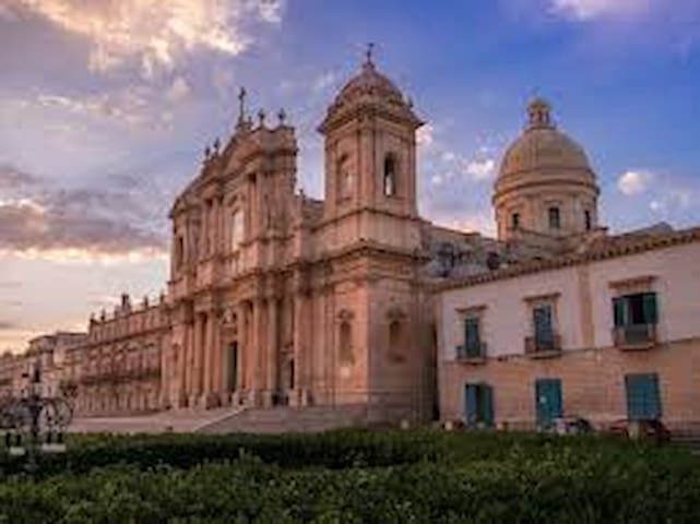
La città di Noto è una delle perle del barocco italiano, centro di fondamentale importanza della Val di Noto, riconosciuta dall’Unesco come Patrimonio dell’Umanità.Una città che si fa amare, uno scrigno di tesori di inestimabile valore, una principessa che ama sfoggiare il suo abito più elegante e sfarzoso. In molti conoscono questa realtà urbana come “Il giardino di pietra”, che grazie alle numerose chiese, i nobiliari palazzi e tante altre strutture che dell’architettura barocca sono la massima espressione, si è fatta conoscere nel mondo, attirando ogni anno un numero impressionante di visitatori.Perché è chiamata giardino di pietra? Tutta la città è stata costruita seguendo le regole dettate dall’urbanistica barocca, dalle strade agli stupendi palazzi nobiliari costruiti con pietra calcarea già presente sul territorio. Quello che più incanta è la scenografia che è stata creata. Si, perché la città di Noto è stata ricostruita dopo il terremoto del 1693, seguendo quello che può essere definito come un progetto dai mille volti, ma tutti con la stessa espressione. Ogni singola costruzione è stata portata a termine con maniacale attenzione ai dettagli simbolo del barocco, in un susseguirsi di facciate decorate, affascinanti balconi e tanti altri particolari che di certo non sfuggiranno agli occhi dei più attenti turisti.
The city of Noto is one of the pearls of Italian Baroque, a center of fundamental importance in the Val di Noto, recognized by UNESCO as a World Heritage Site.
A city that makes itself loved, a treasure chest of inestimable value, a princess who loves to show off her most elegant and luxurious dress. Many know this urban reality as "The Stone Garden", which thanks to the numerous churches, noble palaces and many other structures that are the highest expression of Baroque architecture, has made itself known throughout the world, attracting an impressive number every year of visitors. Why is it called a stone garden? The whole city was built following the rules dictated by baroque town planning, from the streets to the beautiful noble palaces built with limestone already present in the territory. What is most enchanting is the setting that was created. Yes, because the city of Noto was rebuilt after the earthquake of 1693, following what can be defined as a project with a thousand faces, but all with the same expression. Every single building has been completed with maniacal attention to the symbolic details of the Baroque, in a succession of decorated facades, charming balconies and many other details that certainly will not escape the eyes of the most attentive tourists.
Noto in Centro
20 Via ArchimedeLa città di Noto è una delle perle del barocco italiano, centro di fondamentale importanza della Val di Noto, riconosciuta dall’Unesco come Patrimonio dell’Umanità.Una città che si fa amare, uno scrigno di tesori di inestimabile valore, una principessa che ama sfoggiare il suo abito più elegante e sfarzoso. In molti conoscono questa realtà urbana come “Il giardino di pietra”, che grazie alle numerose chiese, i nobiliari palazzi e tante altre strutture che dell’architettura barocca sono la massima espressione, si è fatta conoscere nel mondo, attirando ogni anno un numero impressionante di visitatori.Perché è chiamata giardino di pietra? Tutta la città è stata costruita seguendo le regole dettate dall’urbanistica barocca, dalle strade agli stupendi palazzi nobiliari costruiti con pietra calcarea già presente sul territorio. Quello che più incanta è la scenografia che è stata creata. Si, perché la città di Noto è stata ricostruita dopo il terremoto del 1693, seguendo quello che può essere definito come un progetto dai mille volti, ma tutti con la stessa espressione. Ogni singola costruzione è stata portata a termine con maniacale attenzione ai dettagli simbolo del barocco, in un susseguirsi di facciate decorate, affascinanti balconi e tanti altri particolari che di certo non sfuggiranno agli occhi dei più attenti turisti.
The city of Noto is one of the pearls of Italian Baroque, a center of fundamental importance in the Val di Noto, recognized by UNESCO as a World Heritage Site.
A city that makes itself loved, a treasure chest of inestimable value, a princess who loves to show off her most elegant and luxurious dress. Many know this urban reality as "The Stone Garden", which thanks to the numerous churches, noble palaces and many other structures that are the highest expression of Baroque architecture, has made itself known throughout the world, attracting an impressive number every year of visitors. Why is it called a stone garden? The whole city was built following the rules dictated by baroque town planning, from the streets to the beautiful noble palaces built with limestone already present in the territory. What is most enchanting is the setting that was created. Yes, because the city of Noto was rebuilt after the earthquake of 1693, following what can be defined as a project with a thousand faces, but all with the same expression. Every single building has been completed with maniacal attention to the symbolic details of the Baroque, in a succession of decorated facades, charming balconies and many other details that certainly will not escape the eyes of the most attentive tourists.
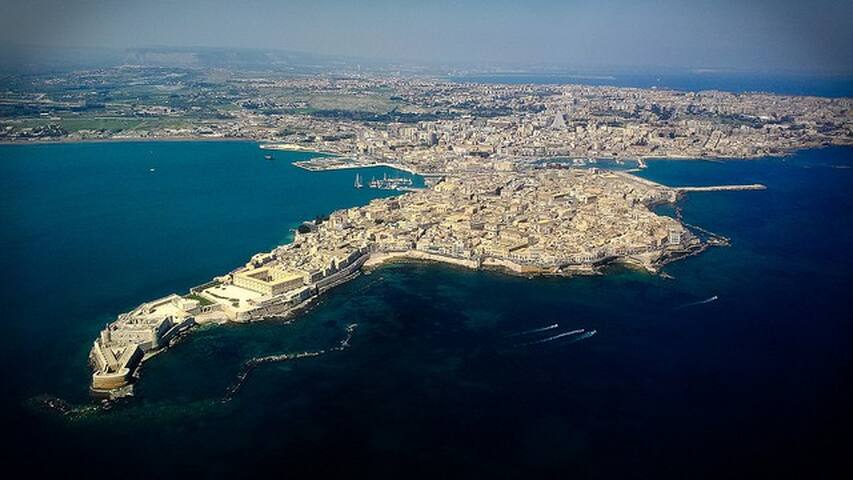
L’isola di Ortigia rappresenta il cuore della splendida città di Siracusa, il primitivo nucleo abitato dove percepire secoli di storia, arte e cultura che hanno contraddistinto questo suggestivo luogo siciliano.
Anche se si tratta di un’isola, essa è collegata alla terraferma tramite il Ponte Umbertino che permette direttamente di passare da Siracusa città all’isola di Ortigia.
The island of Ortigia represents the heart of the splendid city of Syracuse, the primitive inhabited center where to perceive centuries of history, art and culture that have characterized this suggestive Sicilian place.
Even if it is an island, it is connected to the mainland by the Umbertino Bridge which directly allows to pass from Syracuse city to the island of Ortigia.
418 คนท้องถิ่นแนะนำ
Ortigia
L’isola di Ortigia rappresenta il cuore della splendida città di Siracusa, il primitivo nucleo abitato dove percepire secoli di storia, arte e cultura che hanno contraddistinto questo suggestivo luogo siciliano.
Anche se si tratta di un’isola, essa è collegata alla terraferma tramite il Ponte Umbertino che permette direttamente di passare da Siracusa città all’isola di Ortigia.
The island of Ortigia represents the heart of the splendid city of Syracuse, the primitive inhabited center where to perceive centuries of history, art and culture that have characterized this suggestive Sicilian place.
Even if it is an island, it is connected to the mainland by the Umbertino Bridge which directly allows to pass from Syracuse city to the island of Ortigia.
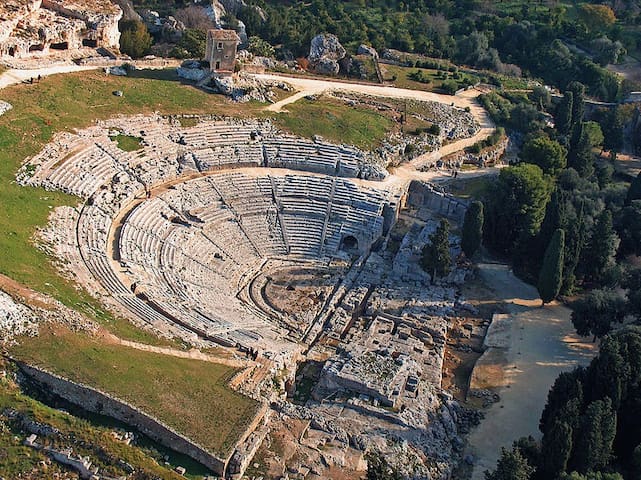
Il Teatro Greco di Siracusa è oggi il monumento più famoso della città, ma anche nell’antichità ebbe grande fama e prestigio internazionali essendo l’edificio per spettacoli più importante del mondo greco-occidentale, altissimo esempio di architettura civile. Fu anche luogo di culto e di grandi assemblee popolari, sede di processi pubblici e, in epoca romana, fu pure adattato a esibizioni circensi e di varietà.The Greek Theater of Syracuse is today the most famous monument of the city, but also in antiquity it had great international fame and prestige being the most important building for shows of the Greek-western world, very high example of civil architecture. It was also a place of worship and large popular assemblies, the site of public trials and, in Roman times, it was also adapted for circus and variety exhibitions.
29 คนท้องถิ่นแนะนำ
Province of Syracuse
Il Teatro Greco di Siracusa è oggi il monumento più famoso della città, ma anche nell’antichità ebbe grande fama e prestigio internazionali essendo l’edificio per spettacoli più importante del mondo greco-occidentale, altissimo esempio di architettura civile. Fu anche luogo di culto e di grandi assemblee popolari, sede di processi pubblici e, in epoca romana, fu pure adattato a esibizioni circensi e di varietà.The Greek Theater of Syracuse is today the most famous monument of the city, but also in antiquity it had great international fame and prestige being the most important building for shows of the Greek-western world, very high example of civil architecture. It was also a place of worship and large popular assemblies, the site of public trials and, in Roman times, it was also adapted for circus and variety exhibitions.
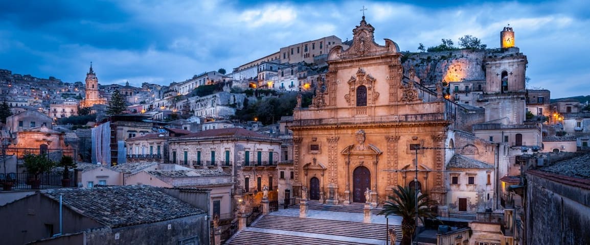
La storica e borghese cittadina di Modica è situata a circa venti kilometri da Ragusa, nella parte sud orientale dell’isola
The historic and middle-class town of Modica is located about twenty kilometers from Ragusa, in the south-eastern part of the island
73 คนท้องถิ่นแนะนำ
Modica Historical Center
11 Via CiaceriLa storica e borghese cittadina di Modica è situata a circa venti kilometri da Ragusa, nella parte sud orientale dell’isola
The historic and middle-class town of Modica is located about twenty kilometers from Ragusa, in the south-eastern part of the island
Offerta gastronomica
Da asporto, Consegna a domicilio, Riserve, Tavoli all'esterno, Area parcheggio gratuita, Accessibile in sedia a rotelle, Vino e birra, Pagamenti digitali
Takeaway, Home delivery, Reserves, Outside tables, Free parking area, Wheelchair accessible, Wine and beer, Digital payments

La Bottega Minimarket
10 Via F. Lorenzomini market via f.Lorenzo lido di noto
spiaggia/mare
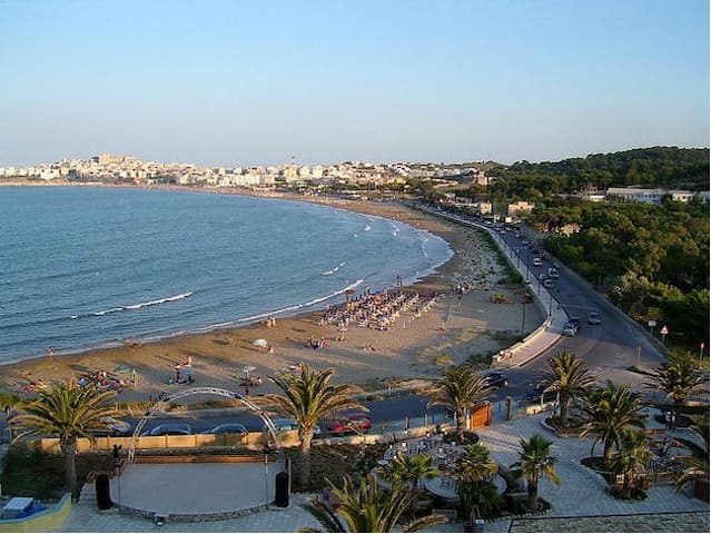
Allo stesso parallelo di Tunisi, sorge un delizioso borgo, Portopalo di Capo Passero, il comune più a sud d’Italia, isole a parte.
Portopalo di Capo Passero è sotto la provincia siracusana, uno spartiacque tra due mari, lo Ionio e il Mediterraneo.
Via Vittorio Emanuele, la via principale, taglia in due il paese e tocca ad est il mar Jonio e ad ovest il Mediterraneo: qui il mare è il padrone assoluto.
La sua costa è caratterizzata da piccole calette rocciose, dove il mare azzurro e cristallino va a insinuarsi e un lungo litorale sabbioso.
Autentiche meraviglie della natura sono i due isolotti che sorgono di fronte al borgo e che fanno parte del comune: l’isola di Capo Passero e l’Isola delle Correnti.
t the same parallel as Tunis, there is a delightful village, Portopalo di Capo Passero, the southernmost municipality of Italy, separate islands.
Portopalo di Capo Passero is below the Syracusan province, a watershed between two seas, the Ionian and the Mediterranean.
Via Vittorio Emanuele, the main street, cuts the town in two and touches the Ionian Sea to the east and the Mediterranean to the west: here the sea is the absolute master.
Its coast is characterized by small rocky coves, where the crystal blue sea goes to creep in and a long sandy coastline.
Authentic wonders of nature are the two islets that rise in front of the village and that are part of the municipality: the island of Capo Passero and the Isola delle Correnti.
134 คนท้องถิ่นแนะนำ
Portopalo di capo Passero SR
Allo stesso parallelo di Tunisi, sorge un delizioso borgo, Portopalo di Capo Passero, il comune più a sud d’Italia, isole a parte.
Portopalo di Capo Passero è sotto la provincia siracusana, uno spartiacque tra due mari, lo Ionio e il Mediterraneo.
Via Vittorio Emanuele, la via principale, taglia in due il paese e tocca ad est il mar Jonio e ad ovest il Mediterraneo: qui il mare è il padrone assoluto.
La sua costa è caratterizzata da piccole calette rocciose, dove il mare azzurro e cristallino va a insinuarsi e un lungo litorale sabbioso.
Autentiche meraviglie della natura sono i due isolotti che sorgono di fronte al borgo e che fanno parte del comune: l’isola di Capo Passero e l’Isola delle Correnti.
t the same parallel as Tunis, there is a delightful village, Portopalo di Capo Passero, the southernmost municipality of Italy, separate islands.
Portopalo di Capo Passero is below the Syracusan province, a watershed between two seas, the Ionian and the Mediterranean.
Via Vittorio Emanuele, the main street, cuts the town in two and touches the Ionian Sea to the east and the Mediterranean to the west: here the sea is the absolute master.
Its coast is characterized by small rocky coves, where the crystal blue sea goes to creep in and a long sandy coastline.
Authentic wonders of nature are the two islets that rise in front of the village and that are part of the municipality: the island of Capo Passero and the Isola delle Correnti.
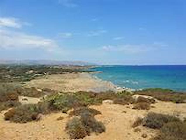
La spiaggia di Marianelli è una spiaggia isolata, selvaggia e incontaminata, inserita tra mandorleti, limoneti e dune di sabbia arricchite da una flora unica.
Si trova nella zona nord della riserva tra la spiaggia di Eloro e Calamosche.
Marianelli beach is a secluded, wild and uncontaminated beach, inserted between almond groves, lemon groves and sand dunes enriched by a unique flora.
It is located in the northern area of the reserve between the Eloro beach and Calamosche.
43 คนท้องถิ่นแนะนำ
ชายหาดมาเรียเนลลี
La spiaggia di Marianelli è una spiaggia isolata, selvaggia e incontaminata, inserita tra mandorleti, limoneti e dune di sabbia arricchite da una flora unica.
Si trova nella zona nord della riserva tra la spiaggia di Eloro e Calamosche.
Marianelli beach is a secluded, wild and uncontaminated beach, inserted between almond groves, lemon groves and sand dunes enriched by a unique flora.
It is located in the northern area of the reserve between the Eloro beach and Calamosche.
La spiaggia di San Lorenzo è un tratto di costa molto affascinante caratterizzato da grandi spiagge e piccole insenature. La fine sabbia chiara è bagnata da un mare turchese e cristallino con fondale dolcemente digradante, che permette anche ai bambini più piccoli di godere del mare in tutta tranquillità.Il litorale è ben attrezzato con strutture e servizi che assicurano giornate di completo relax balneare
The beach of San Lorenzo is a very attractive stretch of coast characterized by large beaches and small coves. The fine white sand is washed by a turquoise and crystalline sea with a gently sloping seabed, which allows even the youngest children to enjoy the sea in complete tranquility.
The coast is well equipped with facilities and services that ensure days of complete seaside relaxation
77 คนท้องถิ่นแนะนำ
San Lorenzo
La spiaggia di San Lorenzo è un tratto di costa molto affascinante caratterizzato da grandi spiagge e piccole insenature. La fine sabbia chiara è bagnata da un mare turchese e cristallino con fondale dolcemente digradante, che permette anche ai bambini più piccoli di godere del mare in tutta tranquillità.Il litorale è ben attrezzato con strutture e servizi che assicurano giornate di completo relax balneare
The beach of San Lorenzo is a very attractive stretch of coast characterized by large beaches and small coves. The fine white sand is washed by a turquoise and crystalline sea with a gently sloping seabed, which allows even the youngest children to enjoy the sea in complete tranquility.
The coast is well equipped with facilities and services that ensure days of complete seaside relaxation
La Riserva Naturale di Vendicari, è stata prevista tramite una legge della Regione Sicilia nel 1981, ma è stata istituita ufficialmente nel 1984, dopo numerose lotte di associazioni ambientaliste e numerosi passaggi burocratici.
La storia della riserva ha però origine molto più antiche. Diverse sono le testimonianze archeologiche ed architettoniche dell’insediamento dell’uomo fin dall’epoca greca.
The Vendicari Nature Reserve, was established by a law of the Sicily Region in 1981, but was officially established in 1984, after numerous struggles of environmental associations and numerous bureaucratic passages.
However, the history of the reserve has a much older origin. There are several archaeological and architectural evidences of human settlement since the Greek era.
22 คนท้องถิ่นแนะนำ
Vendicari
La Riserva Naturale di Vendicari, è stata prevista tramite una legge della Regione Sicilia nel 1981, ma è stata istituita ufficialmente nel 1984, dopo numerose lotte di associazioni ambientaliste e numerosi passaggi burocratici.
La storia della riserva ha però origine molto più antiche. Diverse sono le testimonianze archeologiche ed architettoniche dell’insediamento dell’uomo fin dall’epoca greca.
The Vendicari Nature Reserve, was established by a law of the Sicily Region in 1981, but was officially established in 1984, after numerous struggles of environmental associations and numerous bureaucratic passages.
However, the history of the reserve has a much older origin. There are several archaeological and architectural evidences of human settlement since the Greek era.
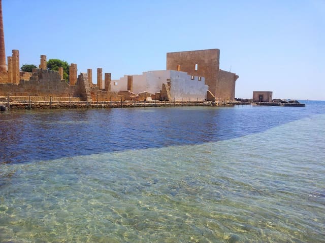
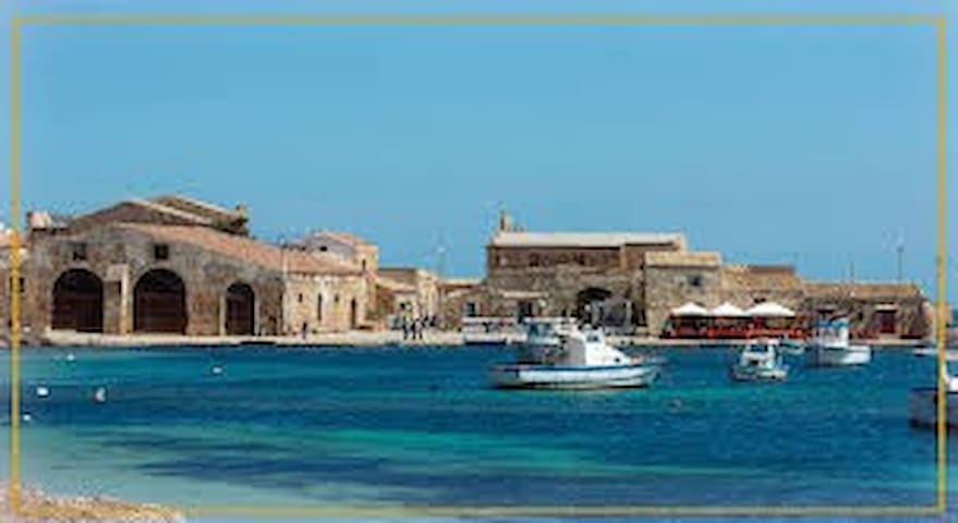
Marzamemi (nome che deriva dall’arabo “Marsà al hamen”, Rada delle Tortore), è un piccolo borgo marinaro della provincia di Siracusa, a pochi chilometri di distanza da Pachino e dalla barocca Noto.
Marzamemi (name deriving from the Arabic “Marsà al hamen”, Rada delle Tortore), is a small fishing village in the province of Syracuse, a few kilometers away from Pachino and the baroque Noto
478 คนท้องถิ่นแนะนำ
Marzamemi
Marzamemi (nome che deriva dall’arabo “Marsà al hamen”, Rada delle Tortore), è un piccolo borgo marinaro della provincia di Siracusa, a pochi chilometri di distanza da Pachino e dalla barocca Noto.
Marzamemi (name deriving from the Arabic “Marsà al hamen”, Rada delle Tortore), is a small fishing village in the province of Syracuse, a few kilometers away from Pachino and the baroque Noto
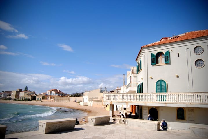
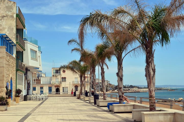
Punta secca è una piccola località balneare in provincia di Ragusa, diventata molto famosa nell’ultimo decennio grazie alle vicende del “Commissario Montalbano”.
Il suo nome PUNTA SECCA, deriva dalla conformazione del suo territorio: qui la spiaggia di sabbia fine è intervallata da zone rocciose che emergono dal mare, le cosiddette secche.
Punta secca is a small seaside resort in the province of Ragusa, which has become very famous in the last decade thanks to the events of the "Commissario Montalbano".
Its name PUNTA SECCA derives from the conformation of its territory: here the beach of fine sand is interspersed with rocky areas that emerge from the sea, the so-called shoals.
137 คนท้องถิ่นแนะนำ
Punta Secca
Punta secca è una piccola località balneare in provincia di Ragusa, diventata molto famosa nell’ultimo decennio grazie alle vicende del “Commissario Montalbano”.
Il suo nome PUNTA SECCA, deriva dalla conformazione del suo territorio: qui la spiaggia di sabbia fine è intervallata da zone rocciose che emergono dal mare, le cosiddette secche.
Punta secca is a small seaside resort in the province of Ragusa, which has become very famous in the last decade thanks to the events of the "Commissario Montalbano".
Its name PUNTA SECCA derives from the conformation of its territory: here the beach of fine sand is interspersed with rocky areas that emerge from the sea, the so-called shoals.
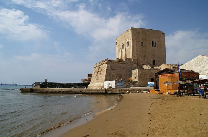
Il comune di Pozzallo si estende interamente sul mare ed è uno dei centri balneari più importanti e frequentati dell’intera provincia ragusana.
La storia di Pozzallo ha origini antichissime, sul suo territorio sono stati infatti ritrovate tracce bizantine e monete romane.
The town of Pozzallo extends entirely on the sea and is one of the most important and popular seaside resorts of the entire province of Ragusa.
The history of Pozzallo has very ancient origins, in its territory Byzantine traces and Roman coins have been found.
98 คนท้องถิ่นแนะนำ
Pozzallo
Il comune di Pozzallo si estende interamente sul mare ed è uno dei centri balneari più importanti e frequentati dell’intera provincia ragusana.
La storia di Pozzallo ha origini antichissime, sul suo territorio sono stati infatti ritrovate tracce bizantine e monete romane.
The town of Pozzallo extends entirely on the sea and is one of the most important and popular seaside resorts of the entire province of Ragusa.
The history of Pozzallo has very ancient origins, in its territory Byzantine traces and Roman coins have been found.
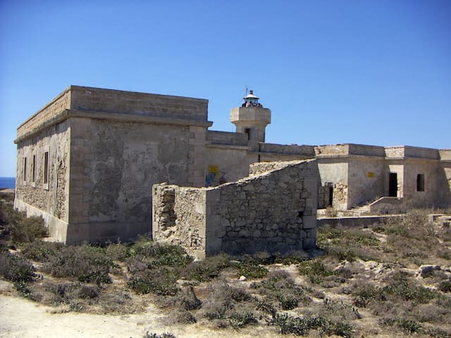
L’Isola delle Correnti è una piccola isola di forma tondeggiante, che si estende per circa 10.000 metri quadri, raggiungendo un’altezza massima di 4m sul livello del mare.
Collegata a Portopalo da una fine lingua di pietra, incanta per la sua bellezza selvaggia ed incontaminata.
The Isola delle Correnti is a small island with a rounded shape, which covers about 10,000 square meters, reaching a maximum height of 4m above sea level.
Connected to Portopalo by a fine stone tongue, it enchants for its wild and pristine beauty.
115 คนท้องถิ่นแนะนำ
Isola delle Correnti
L’Isola delle Correnti è una piccola isola di forma tondeggiante, che si estende per circa 10.000 metri quadri, raggiungendo un’altezza massima di 4m sul livello del mare.
Collegata a Portopalo da una fine lingua di pietra, incanta per la sua bellezza selvaggia ed incontaminata.
The Isola delle Correnti is a small island with a rounded shape, which covers about 10,000 square meters, reaching a maximum height of 4m above sea level.
Connected to Portopalo by a fine stone tongue, it enchants for its wild and pristine beauty.
Marina di Ragusa nasce come antico borgo di pescatori. Si estende lungo il litorale che va dal torrente Biddiemi fino alla Preriserva del fiume Irminio. Inoltrandovi nel suo territorio noterete le antiche masserie dell’800, oggi per lo più in disuso, i caratteristici muri a secco (che ritroverete anche in altre zone del ragusano, e meravigliosi alberi di Carrubo che spuntano qua e la tra la vegetazione mediterranea.
Marina di Ragusa began as an ancient fishing village. It extends along the coast that goes from the Biddiemi stream to the Pre-reserve of the Irminio river. Entering its territory you will notice the ancient 800s farmhouses, nowadays mostly in disuse, the characteristic dry stone walls (which you will also find in other areas of Ragusa, and wonderful Carob trees that emerge here and there among the Mediterranean vegetation.
199 คนท้องถิ่นแนะนำ
Marina di Ragusa
Marina di Ragusa nasce come antico borgo di pescatori. Si estende lungo il litorale che va dal torrente Biddiemi fino alla Preriserva del fiume Irminio. Inoltrandovi nel suo territorio noterete le antiche masserie dell’800, oggi per lo più in disuso, i caratteristici muri a secco (che ritroverete anche in altre zone del ragusano, e meravigliosi alberi di Carrubo che spuntano qua e la tra la vegetazione mediterranea.
Marina di Ragusa began as an ancient fishing village. It extends along the coast that goes from the Biddiemi stream to the Pre-reserve of the Irminio river. Entering its territory you will notice the ancient 800s farmhouses, nowadays mostly in disuse, the characteristic dry stone walls (which you will also find in other areas of Ragusa, and wonderful Carob trees that emerge here and there among the Mediterranean vegetation.
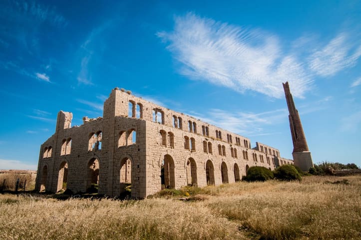
Oggi Sampieri è una meta turistica molto amata, che rimane però fedele a se stessa nel tempo, conservando le caratteristiche del borgo marinaro di un tempo.
Today Sampieri is a very popular tourist destination, but it remains true to itself over time, preserving the characteristics of the maritime village of the past.
56 คนท้องถิ่นแนะนำ
Sampieri
Oggi Sampieri è una meta turistica molto amata, che rimane però fedele a se stessa nel tempo, conservando le caratteristiche del borgo marinaro di un tempo.
Today Sampieri is a very popular tourist destination, but it remains true to itself over time, preserving the characteristics of the maritime village of the past.